
Theme: Survey
![]()
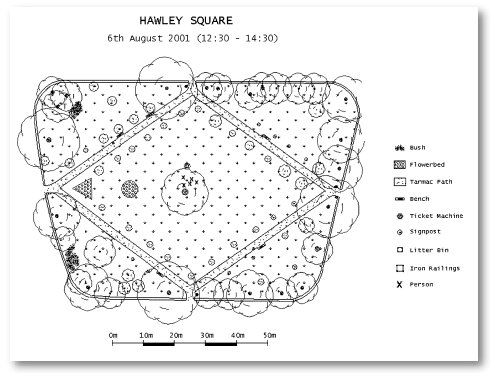
Hawley Square
6th August 2001 (12:30 - 14:30)
Digital plot on paper
A detailed survey of Hawley Square was undertaken to produce a plan
drawing. An instrument called an electronic total station was used to
collect the detail survey information. An electronic total station is
a combination of a theodolite instrument (for measuring horizontal and
vertical angles) and an electromagnetic distance measuring instrument
(EDM). The information (angles and distances) collected for all the
detail points in the square (e.g. trees, paths and walls etc) was recorded
on the electronic total station’s on-board memory card. This information
was later downloaded onto a computer at the IESSG and was edited using
a software package to produce a raw plan of the square. The raw plan
was transferred into an autocad software package to produce the final
enhanced plan drawing.
Back to Hawley Square Exhibition
For further information about this project or web site contact: Gary.Priestnall@nottingham.ac.uk