Spatial Knowledge Acquisition: Exploring the Potential of the Projected Augmented Relief Model (PARM) technique.
January - March 2012
Participants
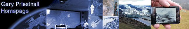
Gary Priestnall
James Goulding (Horizon Digital Economy Research Institute
Laura Kinley (Horizon DTC)
Funding
EPSRC pump priming grant
Project Overview
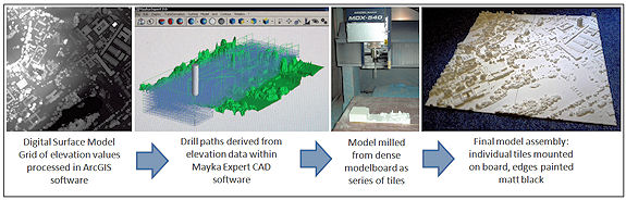
This project explored the feasibility of using a high fidelity Projection Augmented Relief Model (PARM) interface for the effective communication of spatial patterns. The starting point was crude prototype emerging as a by-product from an artist in residency collaboration between Gary Priestnall and Jeremy Gardiner within the EPSRC-funded ‘Towards Pervasive Media’ project. The first step was to refine the process of creating physical models from digital elevation data, in this case high resolution airborne laser-scanning data (LiDAR). This workflow (shown below) was developed with Jake Durrant at Ravensbourne, London.
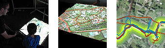
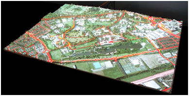
One potential benefit of the PARM display was to provide a more effective representation of spatial patterns than an equivalent 2D display. Theoretically the representation of the third dimension in physical form offered a true 3D display which could make it easier for people to build a picture of a landscape. This project set up an experimental methodology to explore how locations, routes or patterns projected onto the 3D model could be presented to people in a controlled fashion, using a model of University Park, Nottingham (below), led by Horizon Doctoral Training Centre PhD student Laura Kinley.
A major development during this project was the creation of a more powerful and flexible software environment to support dynamic content across multiple displays. This is underpinning further work exploring a more interactive display configuration that might be deployed in a public context, for example a museum.
Research Outcomes
Priestnall, G., Gardiner, J., Durrant, J., and Goulding, J. (2012) Projection Augmented Relief Models (PARM): Tangible Displays for Geographic Information, Proceedings from Electronic Visualisation and the Arts (EVA) London, 2012. [PDF]
Related Links
|