Sustainable futures
Conserving rivers and sustaining livelihoods in remote parts of Borneo
Floods have devastating consequences for millions of people around the world, with rural communities being particularly vulnerable. Finding ways of reducing flood risk and collaborating with communities to help them become more resilient is a critical challenge.
In tropical Southeast Asia, the lives and livelihoods of many rural communities are threatened by flooding caused by a combination of climate and landcover change, especially forest clearance. While it is imperative to help these communities, the measures we adopt must be ecologically sound and protect tropical rivers and their catchments, which are diverse and globally important ecosystems.
Traditional engineering approaches to dealing with flooding and riverbank erosion create as many problems as they solve. For instance, canalizing river channels (straighten, widen and deepen them) to help convey floodwaters downstream often simply moves the problem from one location to another. Similarly, using concrete to protect banks from erosion comes at the cost of lost natural habitats and damage to river ecosystems.
Academics from University of Nottingham Malaysia have been working in partnership with WWF-Malaysia to implement a range of ecologically based flood management practices in the river Trusan. The Trusan is in a remote part of Sarawak, Malaysian Borneo. Communities here are heavily dependent on rice production for food and livelihoods, but their paddies and crops are increasingly threatened by flooding and associated bank erosion. Crops are frequently damaged by floods, forcing paddies to be abandoned. Bank erosion is severe, with several meters of retreat each year in some locations and communities losing valuable land, washed away with each high flow.
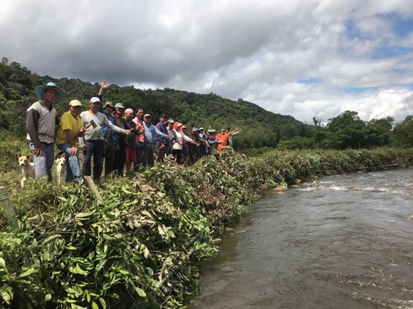
The Nottingham-WWF project has been designed to combine local and academic knowledge to find solutions. Capacity building is a key strategy. We have been evaluating the suitability of a range of green river-bank protection measures, harnessing local knowledge to identity the most suitable tree species to help safeguard the banks from high flows. We train communities to install measures best suited to different locations (photo above), as well as testing their suitability in high energy rivers such as the Trusan. We hope to learn from the work and roll out the most appropriate measures to other similar areas in Borneo.
At the same time, we have been evaluating opportunities for ‘managed flooding.’ By identifying less valuable and/or abandoned areas and allowing them to flood in a controlled way, the likelihood of flooding in more valuable downstream areas is reduced. Data from drones is helping build hydrological models to simulate floods and, in turn, assess potential to reduce this risk through managed flooding.
This work is already providing valuable insights into options for sustainable flood management that will increase community resilience.
Chris Gibbins
Chris Gibbins is a professor in the School of Environmental and Geographical Sciences at the University of Nottingham Malaysia, specialising in freshwater ecology, biogeography, sustainable catchment, and water resources management. His applied research addresses human impacts on aquatic organisms and the sustainable management of rivers and their catchments. Through this work, Professor Gibbins aims to advance our understanding of freshwater ecosystems and promote sustainable practices for their management and restoration.
Email: Christopher.Gibbins@nottingham.edu.my