
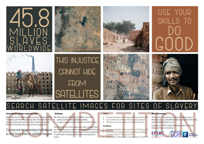
Calling all computer scientists and programmers! Think you’ve got the skills to design an automated program to detect slavery sites in satellite images?
NGOs have found slaves manufacturing bricks in an area of North India and suspect there may be many more. Kilns similar to those where the slaves were found are visible in satellite images but NGOs do not have the resources to scan the images manually.
Can you use image analysis techniques to find brick kilns in satellite images? Researchers at UoN are laying down a challenge.
The Challenge
You will be provided with:
- Landsat, Sentinel and DigitalGlobe satellites
- An expert analysis, which located kilns for half of the area
Your challenge is to combine the expert’s data with your own computing skills to create an automated process that locates kilns in the second half of the area. You may use any combination of satellite data, including your own remote sensing data – on request.
Deadlines
- Predicted kiln locations must be submitted by 9am, Monday 12 February 2018
- You will receive feedback by 5pm, Friday 16 February 2018
- A brief methodology (four pages max) must be submitted by Saturday 21 March 2018
The most accurate entries will receive a £30 Amazon voucher, an invitation to present at a challenge workshop in March 2018 and the opportunity to co-author a paper or for further collaboration.
If you have any questions or requests for data, please contact Jessica Wardlaw or Giles Foody.
Posted on Thursday 21st December 2017