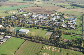
Farm facts and information
The Farm has 446 hectares (1100 acres) based across three land centres:
- Sutton Bonington 221 ha (545 acres)
- Bunny Park 160 ha (395 acres)
- Clifton 65 ha (160 acres)
The main Sutton Bonington site is located on the edge of two National Character Areas: the Trent Valley Washlands and the Leicestershire and Nottinghamshire Wolds.
Across the farm there are a wide range of soil types, including sand, clay, alluvial and loam-based soils.

Click the image to view a map of the University Farm
Environmental information
The farm is within a Nitrate Vulnerable Zone and has environmental features including ponds, beetle banks, field margins, nesting boxes and mature and new woodland areas.
- Precipitation: approximately 600 mm per year
- Summer rainfall: typically between 20 and 30 rain days
- Wind: annual averages 2005-2009: between 3.5 and 4 metres per second, gusts average 7 m/s
- Height: circa 25m (Clifton) to 50m (Bunny Park) above sea level. Sutton Bonington: 35-45m
- COSMOS-UK data for Bunny Park (Courtesy of the Centre for Ecology and Hydrology, CEH)
Enterprises
We have arable (wheat, oilseed rape, beans, maize, triticale), dairy (200 Holsteins, robotically milked, yielding circa 11,500 litres per cow per year) and sheep (cross-bred ewes producing spring lambs for the local market) enterprises, as well as woodland and land in environmental stewardship.