


Mobile-learning applications
The systems vary widely in specification and use. Some examples of mobile learning applications developed under SPLINT at Nottingham are described below:
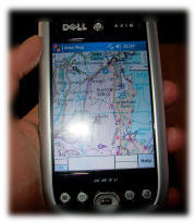
Mobile visualisation field exercise - A PDA-based application has been developed and trialed in Cumbria on both undergraduate and masters level students. The idea behind the exercise is to get students thinking about the accuracy of, and the potentially misleading nature of digital representations of a landscape. It has additional benefits in demonstrating links between geology and landform and vegetation, and in enabling visualisation of historic landscapes. Students generate 3D views from known points on a virtual model of the local landscape (including a recreation of the historical formative glacial scene and geological data landscape drapes). These are then automatically displayed on a GPS linked PDA when the students reach the correct locations in the field. In addition information relating to landscape features visible from these points is generated in the form of audio commentary files. Recently the system has been adapted for use with a GPS linked tablet PC. The tablet PC version has the added advantages of a higher resolution and scalable maps [more].
Virtual World Navigation Game - This tool is designed to practice and investigate navigation in the virtual world environment. Users must navigate to a number of locations within the model in order to collect 'tokens', the locations of which are displayed over a map on the PDA screen. User position is indicated on the map, with the option to display 'hints' showing which token is the closest with every movement. The game is timed, and highscores are recorded for the time taken to collect all tokens.
GPS Logger - A basic GPS application, designed to instruct students in location-aware programming for PDAs and the processing of GPS NMEA data. The completed application displays positional information on screen, and saves a log file that can be plotted in a GIS.
River Channel Profiler - This application is designed for use on Southwell Minster School's A Level physical geography field trip. Students are required to conduct a traditional river survey at three locations, in order to create channel profiles and investigate channel dynamics. This PDA application allows the survey data to be logged, stored and edited digitally. It also draws instant channel profiles on screen from the surveyed data, so students can gain a better understanding of river dynamics while out in the field. You can download a printable leaflet (.pdf) about this application [here].
Customisable Tablet PC Data Logger - This generic application, designed to run on a tablet PC/laptop with Bluetooth GPS, provides a customisable interface with which users may collect and record spatially referenced data. The study area, map layers, data to log etc. can all the altered. Features include a map window with switchable layers, pan, zoom and GPS tacking capabilities, data logging of various types (such as number, string, pick list, georeferenced photos), display of logged locations in the map window with adjustable legend and querying function, and the export of logged data to formats readable in a GIS or spreadsheet.
Location aware 360 degree panorama viewer - This is a custom control for viewing and panning 360 degree panoramic images, to work on a tablet PC or PDA. GPS integration allows content to be delivered in a context-aware fashion, providing 360 degree views of particular locations in the field for comparison with the real world. Integration with a digital compass, or directional data in the virtual environment, will allow automated panning based on orientation.
PDA field co-ordinate converter - an in-field converter to quickly switch data between Lat/Long and British National Grid co-ordinate systems.
Clifton village historical building trail - Built for PDAs using the Mscape platform, this initial pilot application is designed for use by Year 6 students at Highbank Primary School. The aim of the project is to improve skills of map reading, spatial orientation, while engaging with mobile technologies and learning about local history. Users must navigate to a number of buildings of interest, using an onscreen map showing these locations plus their current position. Once in the vicinity of a target building, a historical photograph is displayed. This can then be compared with the modern day view, and an attempt can be made to identify the exact location from which the photo was taken. This exercise is currently being extended further, to incorporate more learning objectives and spatial skills.
Further work has also been undertaken using the MScape platform for various scenarios with various ability groups. You can view/download a printable leaflet (.pdf) about this research [here].